


 ЧЪРкДхФФ ОпАЃЛѓДу ПРЧТ
 11ГтПЌМг МвКёРкИИСЗ 1РЇ
 ГЛАд ИТДТ ОюЧаПј УЃБт
 ИЎОѓ ЧаБГ ЙцЙЎБт
 СжИЛПЁ ГЛАЁ ОЕ КёПыРК?
 УжАэАЁМККё РЬКЅЦЎ СёБтБт
 ЧіСіПЁМЕЕ ЧЪРкДхФФ!
 ЧіСіПЁМ АЁДЩЧб


 ЧЪРк ЦЏБо Ч§ХУ! ФСНУОюСі МКёНК


 АЁСЗПЌМіЗЮ ДйЧдАд ОзЦМКёЦМ

-
МјРЇСІИёСЖШИМі
-
 И№ОЫ КИОЫ Йъ ЗЛЦЎЧЯБт~ ИЎСЖЦЎ ПЙОрБюСі
 88,222
 -
 [ЧЪИЎЧЩ ММКЮ] ФЋИ№ХзНК ПЉЧр 100Йш СёБтБт 38,771
 -
 ИЖДвЖѓ НУГЛ - ИЎРп АјПјСЄКИ. (ЛчСј 16Рх ЦїЧд) 30,149
 -
 ММКЮРЧ СіПЊСЄКИ15,143
 -
 ИЖДвЖѓ БйБГ - ЕћАЁРЬЕћРЬ ПЉЧр СЄКИ13,677
 -
 [ЧЪИЎЧЩ ММКЮ/ИЗХК] ШЃХк МїЙк ПфБн Йз СЄКИ12,681
 -
 КИЖѓФЋРЬРЧ И№Еч И№НРРЛ КММі РжДТ ЛчСјУИ.12,564
 -
 ИЖДвЖѓ БйБГ - ЦХЛѓЧб ЦјЦї ПЉЧрСЄКИ12,118
 -
 [ММКЮ-ЙшМБТјРх] МБЙкШИЛч РќШЙјШЃПЁПф~11,682
 -
 ИЖДвЖѓ СіПЊ(ПЁИЃЙЬХИ -ИЛЖѓХз)РЧ СіЕЕ/ЧбБЙ РННФСЁ/МюЧЮИє11,574


- РЬИЇ : tutors
- РлМКРЯ : 2012-12-17
- СЖШИМі : 2024
- УпУЕМі : 0
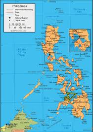
Camiguin Philippines
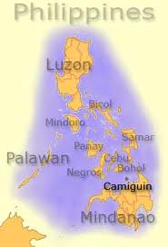
Camiguin (Tagalog pronunciation: [kami'gin], (Cebuano: Lalawigan sa Camiguin), (Tagalog: Lalawigan ng Camiguin) is an island province of the Philippines located in the Bohol Sea, about 10 km (6.2 mi) off the northern coast of Mindanao. It is politically part of the Northern Mindanao Region of the country and formerly a part of Misamis Oriental province. Camiguin is the second-smallest in the country both in population and land area after Batanes. Mambajao is the capital of the province and its largest municipality both in area and population.
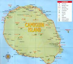
Geography
Camiguin is a pearl-shaped island with an area of approximately 238 km2 (92 sq mi). The island measures about 23 kilometres (14 mi) at its longest and 14.5 kilometres (9.0 mi) at its widest breadth. The island is mountainous with the highest elevation reaching over 5,000 ft (1,500 m). It is encircled by a national road with a total length of about 64 kilometres (40 mi). As of the August 1, 2007 census, the province has a 5th class income classification with a population of 81,293.
History
Etymology
The name Camiguin is derived from the native word тKamagongт, a species of the ebony tree that thrives near Lake Mainit in the province of Surigao del Norte, the region from which the earlier inhabitants of the islands, the Manobos, came. Kinamigin, the local language of Camiguin, is closely related to the Manobo language.
An earlier Spanish geography book writes the island as "Camiguing". There is reason to suppose the Spaniards dropped the final g.
Spanish Colonial Era
Old Spanish documents indicate that the renowned explorers Ferdinand Magellan and Miguel López de Legazpi landed in Camiguin in 1521 and 1565, respectively. The first Spanish settlement was established in 1598 in what is now Guinsiliban. Guinsiliban which comes from the old Kinamiguin word тGinsil-ipanт which means тto look out for pirates from a watchtowerт has an old Spanish watchtower where the Camiguinons kept watch for Moro pirates.
The first major Spanish settlement established in 1679 was called Katagman or Katadman (known as Catarman). The settlement grew and prospered but was destroyed by the eruption of Mt. Vulcan in 1871. The former location is what is now Barangay Bonbon of Catarman.
Sagay, located south of Catarman, was formally established as a town in 1848. The word Sagay is derived from the name of poisonous fruit tree that grow in the area. Mambajao became a town in 1855. The name was coined from the Visayan terms тmamahawт, meaning to usher breakfast, and тbajaoт, which is leftover boiled rice. In the early 1900s, Mambajao prospered to become the busiest port in Northern Mindanao. Mahinog was established as a municipality in 1860. The name Mahinog comes from a Visaya word meaning тto ripenт or тto become ripeт. Although Guinsiliban was the oldest settlement in the island, it was only in 1950 when it became a municipality. Mahinog was formerly governed by Mambajao while Guinsiliban was formally governed from Sagay.
American Colonial Era
In 1901, in the middle of the Philippine-American War, American soldiers landed in Camiguin to assume political control over the island. A group of Camiguinons, armed with bolos and spears, led by Valero Camaro, fought them in a short battle in Catarman. Valero Camaro was killed by a bullet on the forehead and became one of the Camiguin patriots of the early independence movement.
In 1903, the first public school in Camiguin was built in Mambajao and in 1904 the first public water system was installed.
World War II
On June 18, 1942, the Japanese Imperial Army landed in Camiguin and set up a government in Mambajao. They gutted central Mambajao in reprisal to guerrilla activities in the area. The remains of some of these buildings still exist today.
Independence
On July 4, 1946, the Philippines gained independence from the US. Camiguin was then part of Misamis Oriental. In 1958, it became a sub-province and was made into a separate province on June 18, 1966, and formally inaugurated in 1968.
People and language
The people of Camiguin are called Camiguingnon or Camiguinon. The dialects widely spoken in the province are Cebuano and Hiligaynon while only a few people still speak Kinamigin, the ancient tribal dialect of Camiguin. Only in the municipality of Sagay is where the people has retained the usage of the Kinamigin language. English is also widely spoken by the local population.
Education
Camiguin has three colleges, namely: Fatima College of Camiguin (FCC), Camiguin Polytechnic State College (CPSC), with a satellite campus and Camiguin School of Arts and Trades (CSAT) and a technical education offered by the Technical Education and Skills Development Authority (TESDA). A complete secondary and elementary education is available as well, both in private and public. There are also day care centers which offer nursery and pre-school education.
The province has a total number of 68 day care centers managed by the Department of Social Welfare and Development (DSWD) and 56 public and private elementary schools. There are 13 secondary schools, 3 private institutions and the rest are government-owned. There is one special school, which accommodates to the underprivileged or special children, the Family-to-Family School and Farm. It is managed by a Non-Government Organization (NGO).
There is also the Alternative Learning System Education Sector which helps individuals through its literacy cum livelihood.
Economy
The economy is based upon fishing and farming, with copra providing the greatest income contribution. Other agricultural products are abaca, rice, mangoes, lanzones and other fruit trees. The growing tourism industry have improved the economy of the province. Small cottage industries have increased in number to accommodate the influx of visitors.
Natural attractions
Islands
Located just a few kilometers off the coast are the two islands of Camiguin.
- White Island is accessed from Agoho which is about 5 km (3.1 mi) west of the town of Mambajao.
- Mantigue Island can be reached from Mahinog about 14 kilometres (8.7 mi) south of Mambajao.
Springs
- Ardent Hot Spring. At the foot of Hibok-Hibok Volcano bubble the mineral pools of Ardent Hot Springs. Wisps of steam can be seen rising from the running waters heat by the cauldron of the mountain, the most recently active of the seven volcanoes on the island.
- Sto. Niño Cold Springs and Bura Natural Soda Water Swimming Pool in Catarman are other popular places to get a relaxing dip on the island.
- Tangub Hot Spring is an interesting hot spring located on the shore close to the Sunken Cemetery. Most of the spring is submerged and can be partly seen during low tide. The spring can also be examined by scuba diving or snorkeling, as visibility is excellent and it is also a recommended spot for observing underwater life.
Sunken Cemetery
During the volcanic birth of Mt. Vulcan that lasted from 1871 to about 1875, some areas in the town of Bonbon subsided, sinking the cemetery of the town to below sea level. The place is commemorated by a huge cross erected in 1982.
Waterfalls
- Katibawasan Falls. Located 5 km (3.1 mi) southeast of Mambajao, the Katibawasan Falls cascades 250 ft (76 m) down to a pool surrounded by orchids and ferns. An invigorating dip on the pool is popular especially on warmer days and several hiking trails are within the park. This is also the favorite jump-off point for trekkers and mountaineers in search of adventure on the slopes of Mt. Timpoong.
- Tuasan Falls is located 6 km (3.7 mi) northeast of Catarman. Getting to the falls entails a very scenic hike passing through the Barrio of Mainit, Catarman and along the rocky river bed. The pool below the waterfalls is deep and clear. The surrounding scenery is unspoiled and perfect for a peaceful picnic, the only sounds around you is that of the tumbling falls and running water.
Man Made Attractions
Lanzones Festival
Each year in October, a festival is held celebrating the Lanzones, a small grape-sized tropical fruit grown all over the island. The week-long Lanzones Festival is one of the more colorful events in the Philippines.
Churches
Several centuries-old Spanish Colonial and 20th century churches are found in various parts of the island.
Santo Rosario Church
The Santo Rosario Church in the municipality of Sagay was built in 1882.
Old Catarman Church Ruins
The church of the Old Catarman town was destroyed and partly submerged by volcanic debris during the eruption and formation of Mt. Vulcan from 1871 to 1875. Also known as Gui-ob Church, only the ruins of the church and bell tower remains of the old town. An unsightly modern white lighthouse was recently erected close to the bell tower.
Baylao Church
The Church located in Brgy. Baylao in Mambajao is claimed to be miraculous attributed to saving many lives during the last volcanic eruption of Hibok-hibok.


- ЁЄ
- ЁЄ
- ЁЄ
- ЁЄ
- ЁЄ
- ЁЄ
- ЁЄ
- ЁЄ
- ЁЄ
- ЁЄNmjNUuzXqd
- ЁЄNmjNUuzXqd
- ЁЄNmjNUuzXqd
- ЁЄNmjNUuzXqd
- ЁЄNmjNUuzXqd
- ЁЄNmjNUuzXqd


-
МПяМОХЭ :МПя АГВБИ ХзЧьЖѕЗЮ27Бц 8, 10Уў (ПЊЛяЕП, ПЅХИПі)02-3482-0542
-
УЛСжМОХЭ :УцКЯ УЛСжНУ ЛѓДчБИ ЛчСїДыЗЮ 350ЙјБц 11-2, 3Уў(МЙЎЕП)043-221-0543
-
КЮЛъМОХЭ :КЮЛъБЄПЊНУ КЮЛъСјБИ СпОгДыЗЮ 721-1, 5Уў(КЮРќЕП)051-808-0515
-
УЂПјМОХЭ :АцГВ УЂПјНУ МКЛъБИ ДмСЄЗЮ 9, 12Уў (ЛѓГВЕП, ХфХфНККєЕљ)055-282-9345


-
ЛчРЬЦЎ СЂМгРк ХыАш
-
ПРДУ259ОюСІ382
-
ЧбДо33,515ДЉРћ12,191,462
-
РЯРЯУжАэ94,672ШИПјМі20,299