


 ЧЪРкДхФФ ОпАЃЛѓДу ПРЧТ
 11ГтПЌМг МвКёРкИИСЗ 1РЇ
 ГЛАд ИТДТ ОюЧаПј УЃБт
 ИЎОѓ ЧаБГ ЙцЙЎБт
 СжИЛПЁ ГЛАЁ ОЕ КёПыРК?
 УжАэАЁМККё РЬКЅЦЎ СёБтБт
 ЧіСіПЁМЕЕ ЧЪРкДхФФ!
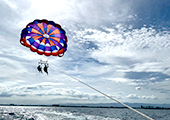 ЧіСіПЁМ АЁДЩЧб


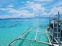 ЧЪРк ЦЏБо Ч§ХУ! ФСНУОюСі МКёНК


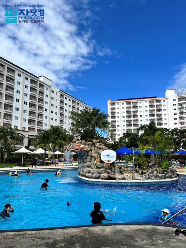 АЁСЗПЌМіЗЮ ДйЧдАд ОзЦМКёЦМ

-
МјРЇСІИёСЖШИМі
-
 И№ОЫ КИОЫ Йъ ЗЛЦЎЧЯБт~ ИЎСЖЦЎ ПЙОрБюСі
 88,223
 -
 [ЧЪИЎЧЩ ММКЮ] ФЋИ№ХзНК ПЉЧр 100Йш СёБтБт 38,782
 -
 ИЖДвЖѓ НУГЛ - ИЎРп АјПјСЄКИ. (ЛчСј 16Рх ЦїЧд) 30,150
 -
 ММКЮРЧ СіПЊСЄКИ15,143
 -
 ИЖДвЖѓ БйБГ - ЕћАЁРЬЕћРЬ ПЉЧр СЄКИ13,681
 -
 [ЧЪИЎЧЩ ММКЮ/ИЗХК] ШЃХк МїЙк ПфБн Йз СЄКИ12,682
 -
 КИЖѓФЋРЬРЧ И№Еч И№НРРЛ КММі РжДТ ЛчСјУИ.12,564
 -
 ИЖДвЖѓ БйБГ - ЦХЛѓЧб ЦјЦї ПЉЧрСЄКИ12,118
 -
 [ММКЮ-ЙшМБТјРх] МБЙкШИЛч РќШЙјШЃПЁПф~11,683
 -
 ИЖДвЖѓ СіПЊ(ПЁИЃЙЬХИ -ИЛЖѓХз)РЧ СіЕЕ/ЧбБЙ РННФСЁ/МюЧЮИє11,576


- РЬИЇ : jilo
- РлМКРЯ : 2012-03-07
- СЖШИМі : 2171
- УпУЕМі : 2
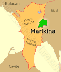
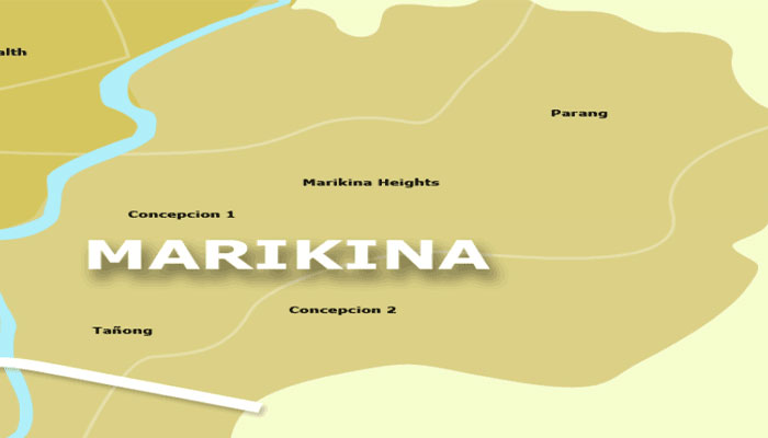
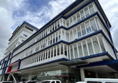
Marikina, officially the City of Marikina, was former capital of the province of Manila during the declaration
of Philippine Independence and one of the sixteen cities within the Manila Metropolitan Area. Marikina is part of
Eastern Manila District of Metro Manila's four districts. It is located on the eastern border of Metro Manila of the
island of Luzon. Several cities and municipalities lies on its border: San Mateo, Rizal, to the north and northeast, Antipolo City to the east, Cainta, Rizal, to the southeast, Pasig City to the south and Quezon City to the entire
west.
Marikina was given the title the "Shoe Capital of the Philippines" because of its notable shoe industry.
Shoemakers in the city recently finished creating the "World's Largest Pair of Shoes" and it was only recently
that the Guinness World Records recognized this feat. The Shoe Museum located in the city is the home of the
famous shoe collection of the former First Lady Imelda Marcos, shoes of the world leaders, past presidents,
famous celebrities and persons, shoes of different countries around the world etc., and contains the largest
collection of pair of shoes in the world.
Marikina was divided into two districts consisting of 16 barangays. The people of Marikina are amongst the
most disciplined in the Philippines. Marikina City is considered as one of the healthiest and livable cities within
the Asia-Pacific. Marikina City is one of the wealthiest local government units (LGU) in the Philippines in terms
of current assets, cash in banks, share of internal revenue allotment (IRA), gross income and gross net income.
The city features many spacious parks, tree-lined streets, bikelanes, boulevards and commercial areas. Despite the latter, most of the city is classified as residential. It was devastated by Typhoon Ondoy in 2009. The most
influential persons in the city is former mayor Marides Fernando and former MMDA Chairman Bayani Fernando,
who was also previously a mayor. Both Fernandos were credited for the city's radical transformation and
improvement. The incumbent mayor is Del De Guzman.
Geography
Marikina City is one of the large distribution in Metro Manila in terms of land area at approximately 21.5 square
kilometers (2,150 hectares), about 3.37% of the total land area of Metro Manila. The city lies on the Marikina
Valley. Not only is Marikina City a part of this valley, the valley extends to the south towards Pasig City and
Cainta, Rizal. Marikina River runs through the central portion of the city and Nangka River runs through the north portion. The dynamic Sierra Madre Mountains, the longest mountain range in the Philippines is located at the eastern portion while the Quezon City hills are located to the west. It is also the home of the Valley Fault System
, one of the active faults in the Philippines.
History
The Augustinians were the first to arrive at the valley, at the spot now known as Chorillo, in Barangay Barangka. The Jesuits next came in 1630 in a place called Jesús de la Peña. They established a mission and built a
chapel where the first mass in Marikina was held. On April 16 , 1630, Fray Pedro de Arce, apostolic ruler of the
Archbishop of Manila, approved the transfer of ecclesiastical control and supervision of Marikina area to the
Jesuits. The area was later called Mariquina in 1787 after Felix Berenguer de Marquina who was the
governor-general at that time, and Mariquina was declared a pueblo (officially town) under the Spanish colonial government.
City

The city lies on a valley of the same name. Marikina River runs through the mid-west portion of the city. There
are two distinct seasons namely dry season from November to April and wet season from May to October


- ЁЄ
- ЁЄ
- ЁЄ
- ЁЄ
- ЁЄ
- ЁЄ
- ЁЄ
- ЁЄ
- ЁЄ
- ЁЄNmjNUuzXqd
- ЁЄNmjNUuzXqd
- ЁЄNmjNUuzXqd
- ЁЄNmjNUuzXqd
- ЁЄNmjNUuzXqd
- ЁЄNmjNUuzXqd


-
МПяМОХЭ :МПя АГВБИ ХзЧьЖѕЗЮ27Бц 8, 10Уў (ПЊЛяЕП, ПЅХИПі)02-3482-0542
-
УЛСжМОХЭ :УцКЯ УЛСжНУ ЛѓДчБИ ЛчСїДыЗЮ 350ЙјБц 11-2, 3Уў(МЙЎЕП)043-221-0543
-
КЮЛъМОХЭ :КЮЛъБЄПЊНУ КЮЛъСјБИ СпОгДыЗЮ 721-1, 5Уў(КЮРќЕП)051-808-0515
-
УЂПјМОХЭ :АцГВ УЂПјНУ МКЛъБИ ДмСЄЗЮ 9, 12Уў (ЛѓГВЕП, ХфХфНККєЕљ)055-282-9345


-
ЛчРЬЦЎ СЂМгРк ХыАш
-
ПРДУ36ОюСІ374
-
ЧбДо33,515ДЉРћ12,191,613
-
РЯРЯУжАэ94,672ШИПјМі20,299