


 ЧЪРкДхФФ ОпАЃЛѓДу ПРЧТ
 11ГтПЌМг МвКёРкИИСЗ 1РЇ
 ГЛАд ИТДТ ОюЧаПј УЃБт
 ИЎОѓ ЧаБГ ЙцЙЎБт
 СжИЛПЁ ГЛАЁ ОЕ КёПыРК?
 УжАэАЁМККё РЬКЅЦЎ СёБтБт
 ЧіСіПЁМЕЕ ЧЪРкДхФФ!
 ЧіСіПЁМ АЁДЩЧб


 ЧЪРк ЦЏБо Ч§ХУ! ФСНУОюСі МКёНК


 АЁСЗПЌМіЗЮ ДйЧдАд ОзЦМКёЦМ

-
МјРЇСІИёСЖШИМі
-
 И№ОЫ КИОЫ Йъ ЗЛЦЎЧЯБт~ ИЎСЖЦЎ ПЙОрБюСі
 88,205
 -
 [ЧЪИЎЧЩ ММКЮ] ФЋИ№ХзНК ПЉЧр 100Йш СёБтБт 38,680
 -
 ИЖДвЖѓ НУГЛ - ИЎРп АјПјСЄКИ. (ЛчСј 16Рх ЦїЧд) 30,144
 -
 ММКЮРЧ СіПЊСЄКИ15,141
 -
 ИЖДвЖѓ БйБГ - ЕћАЁРЬЕћРЬ ПЉЧр СЄКИ13,667
 -
 [ЧЪИЎЧЩ ММКЮ/ИЗХК] ШЃХк МїЙк ПфБн Йз СЄКИ12,676
 -
 КИЖѓФЋРЬРЧ И№Еч И№НРРЛ КММі РжДТ ЛчСјУИ.12,556
 -
 ИЖДвЖѓ БйБГ - ЦХЛѓЧб ЦјЦї ПЉЧрСЄКИ12,108
 -
 [ММКЮ-ЙшМБТјРх] МБЙкШИЛч РќШЙјШЃПЁПф~11,678
 -
 ИЖДвЖѓ СіПЊ(ПЁИЃЙЬХИ -ИЛЖѓХз)РЧ СіЕЕ/ЧбБЙ РННФСЁ/МюЧЮИє11,570


- РЬИЇ : tutors
- РлМКРЯ : 2012-07-26
- СЖШИМі : 2819
- УпУЕМі : 0
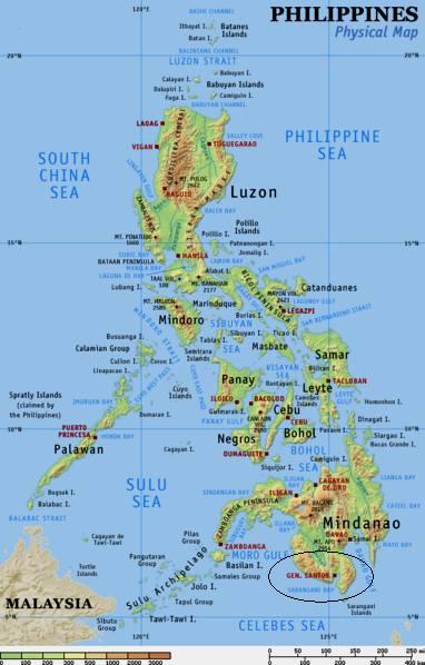
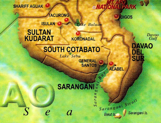
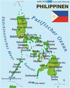
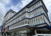
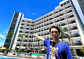
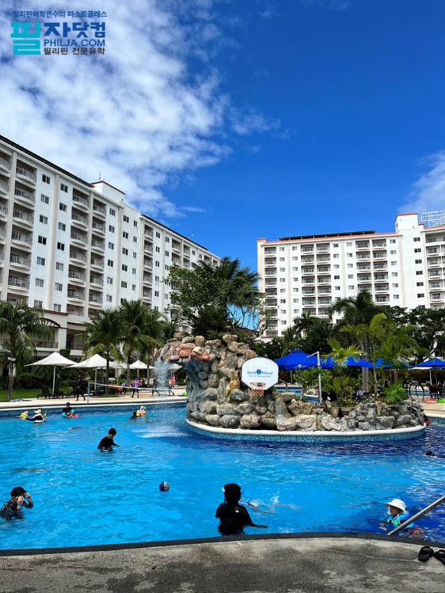
GENERAL SANTOS CITY
General Santos City, which the locals customarily call Gensan, is a city in the southern Philippines. It is located in the island of Mindanao and is within the South Cotabato province. Northwest of Gensan is Cebu City and to its northeast is Davao, two popular destinations in the southern Philippines.
The city began with only 62 pioneers from the island Luzon cultivating the lands in Cotabato led by General Paulino Santos. After this settlement was established came migrants from other major islands like Luzon and the Visayas. The territory became a municipality in 1948 and gained its status as a city in 1968.
Gensan's agriculture sector and fishing industry are quite strong. The strong agricultural sector growth can be attributed to the typhoon-free weather the city enjoys. The city also enjoys good rainfall, much to the advantage of local farmers. Major produce here include pineapples, rice, asparagus, corn, coconuts, exotic fruits, vegetables, and fruits.
Other than a strong agricultural sector, the fishing industry is also strong in General Santos City thus making Gensan the Philippines' tuna capital. There is a top of the line Fishport Complex, which also houses refrigeration facilities. Tuna exporting is a big business in Gensan and tuna fish is the city's biggest export. This industry contributes more than 50% to the city's economy.
The Gensan Climate
The people of General Santos City enjoy a storm-free weather year in and year out. However, there is still a notable dry and wet season in this region. The best time to visit Gensan is from November to May during the dry season. The wet season, marked by tropical rainfall, is from June to October.
The temperature ranges in the city from 28 degrees Celsius to 36 degrees Celsius. Nevertheless, since the city is situated away from the Philippines' typhoon belt, visitors can still enjoy great weather here in spite of occasional tropical rains during the wet season.
|
HISTORY |
|
General Santos City's history dates back to the turn of the 15th century when Sariph Kabungsuan of Arabia arrived in Cotabato Province in Mindanao to introduce Islam. |
|
PHYSICAL PROFILE | |
|
| |
|


- ЁЄ
- ЁЄ
- ЁЄ
- ЁЄ
- ЁЄ
- ЁЄ
- ЁЄ
- ЁЄ
- ЁЄ
- ЁЄNmjNUuzXqd
- ЁЄNmjNUuzXqd
- ЁЄNmjNUuzXqd
- ЁЄNmjNUuzXqd
- ЁЄNmjNUuzXqd
- ЁЄNmjNUuzXqd


-
МПяМОХЭ :МПя АГВБИ ХзЧьЖѕЗЮ27Бц 8, 10Уў (ПЊЛяЕП, ПЅХИПі)02-3482-0542
-
УЛСжМОХЭ :УцКЯ УЛСжНУ ЛѓДчБИ ЛчСїДыЗЮ 350ЙјБц 11-2, 3Уў(МЙЎЕП)043-221-0543
-
КЮЛъМОХЭ :КЮЛъБЄПЊНУ КЮЛъСјБИ СпОгДыЗЮ 721-1, 5Уў(КЮРќЕП)051-808-0515
-
УЂПјМОХЭ :АцГВ УЂПјНУ МКЛъБИ ДмСЄЗЮ 9, 12Уў (ЛѓГВЕП, ХфХфНККєЕљ)055-282-9345


-
ЛчРЬЦЎ СЂМгРк ХыАш
-
ПРДУ19ОюСІ461
-
ЧбДо33,515ДЉРћ12,189,463
-
РЯРЯУжАэ94,672ШИПјМі20,299